Ganvie

Location: Atlantique, Benin
Coordinates: 6.467 N 2.416 E

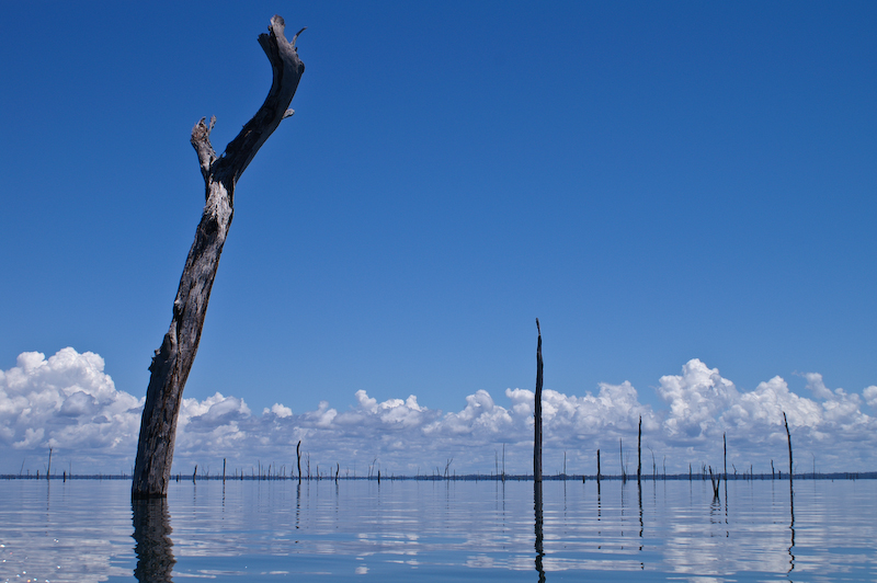
Ganvie is a lake village near the northern edge of Lake Nokoue. Dubbed “Venice of Africa”, it is popular among tourists since it is the largest of its kind in Africa. Houses are built on stilts while inhabitants carry about their daily lives in small boats. The village was founded by the Tofinu people in the 17th century, as a sanctuary from Fon slavers who were forbidden from entering water due to religious reasons.

Main article:
http://en.wikipedia.org/wiki/Ganvie


Temple Of All Religions

Location: Kazan, Russia
Coordinates: 55.801 N 48.975 E

Also known as Temple Of The Universe, popular landmark in combines the architectural characteristics of several world religions. It is not a place or worship; rather as a cultural center that promotes the peaceful assimilation of various faiths. Construction started in 1992 and is still in progress. Upon completion, there will be 16 towers, corresponding 16 of the world’s religions.

Main article:
http://en.wikipedia.org/wiki/Temple_of_All_Religions


Lake Titicaca

Location: Puno, Peru / La Paz, Bolivia
Coordinates: 15.907 S 69.305 W

Lake Titicaca straddles along the border between Peru and Bolivia. Remnants of an ancient sea, this lake is the highest commercially navigable lake in the world. It is divided into 2 sub-basins that are connected by the Strait of Tiquina, just 800 meters at the narrowest point. Although Bolivia became a landlocked country after being defeated by Chile in War of the Pacific, she still maintains a sizeable navy on Lake Titicaca. This is because Bolivia has not become reconciled with the loss of her coast and hopes to recover it one day.

Main article:
http://en.wikipedia.org/wiki/Lake_Titicaca


Mount Roraima

Location: Cuyuni-Mazaruni, Guyana / Bolivar, Venezuela / Roraima, Brazil
Coordinates: 5.195 N 60.737 W

This odd-shaped mountain is defended by 400-meters vertical cliffs on all sides, forming a difficult-to-access tabletop. It also marks the triple border among Guyana, Venezuela and Brazil. Geologically speaking, the Mount Roraima is one of the oldest formations on Earth, dating back 2 billion years ago in the Precambrian Era.

Main article:
http://en.wikipedia.org/wiki/Mount_Roraima


Mount Kilimanjaro

Location: Kilimanjaro, Tanzania
Coordinates: 3.065 S 37.359 E

Mount Kilimanjaro is a volcano in northeastern Tanzania, rising nearly 6 kilometers above sea level. This makes it the highest mountain in Africa and one of the Seven Summits. Kilimanjaro consists of three volcanic cones – Kibo, Mawenzi and Shira. The fumaroles on Kibo are evidence that the now-dormant volcano may erupt again.

Main article:
http://en.wikipedia.org/wiki/Mount_Kilimanjaro


Jim Jim Falls

Location: Northern Territory, Australia
Coordinates: 13.272 S 132.840 E

Jim Jim Falls a popular tourist attraction in Kakadu National Park, a UNESCO World Heritage Site. The amount of water varies greatly with season – from a mere tinkle during dry season, to a raging waterfall over 200 meters during wet season. However, the area is not accessible by road during wet season, so visitors have to come by flight.

Main article:
http://en.wikipedia.org/wiki/Jim_Jim_Falls


Stone Mountain

Location: Georgia, United States
Coordinates: 33.805 N 84.145 W

Stone Mountain is a well-known rock formation near Atlanta, Georgia. Standing 250 meters above the surrounding area, it extends another 14 kilometers underground. What is exposed is just tip of the iceberg. In addition, there is an enormous carving on the north side of the exposed rock – three leaders of the Confederate States during the American Civil War.

Main article:
http://en.wikipedia.org/wiki/Stone_Mountain


Baikonur Cosmodrome

Location: Kyzylorda, Kazakhstan
Coordinates: 45.965 N 63.305 E

Baikonur Cosmodrome is a busy spaceports since the Soviet Era, and still plays an active role in the International Space Station (ISS) project. It is located in the desert steppes of Kazakhstan, but the facility and surrounding area are currently leased to Russia space agencies. There are more than a dozen launchpads within the vast area of 90-kilometer diameter. Normally, space stations are placed near the Equator to take maximum advantage of Earth’s rotational speed, like the Guiana Space Centre in French Guiana. However, the Cold War forced the Soviets to operate here as it is as close as possible to the Equator and still within Soviet borders.

Main article:
http://en.wikipedia.org/wiki/Baikonur_Cosmodrome


Yasawa Islands

Location: Western Division, Fiji
Coordinates: 17.322 S 177.134 E

Yasawa Islands are an archipelago about 100 kilometers to the northwest of the Fiji’s main island. It stretches for diagonally from northeast to southwest for approximately 200 kilometers. Tourism is the main economy, but an entry permit is required to visit most of the islands. Before 1987, the island chain is off-limits to foreigners except cruise ships.

Main article:
http://en.wikipedia.org/wiki/Yasawa_Islands


Cape Of Good Hope

Location: Western Cape, South Africa
Coordinates: 34.357 S 18.497 E

This cape was originally named “Cape of Tempests” by Portuguese explorer Bartolomeu Dias in 1488, during his voyage to find a sea route between Europe and Far East. Contrary to popular belief, this is not the southernmost point of the African continent; This distinction belongs to Cape Agulhas about 150 kilometers down the coastline.

Main article:
http://en.wikipedia.org/wiki/Cape_of_Good_Hope


Brokopondo Reservoir

Location: Brokopondo, Suriname
Coordinates: 4.758 N 55.125 W

Covering 1% of the nation’s land area, this Surinamese reservoir is one of the largest in the world. Trees were not felled before the rainforest was flooded, so tree trunks can still be seen sticking out of the water surface. Brokopondo Reservoir is notorious for being highly inefficient, generating only 30 megawatts of electricity. In comparison, the Three Gorges Dam in China floods a smaller area but generates 18,000 megawatts.

Main article:
http://en.wikipedia.org/wiki/Brokopondo_Reservoir


Mount Kailash

Location: Tibet, China
Coordinates: 31.067 N 81.312 E

This prominent mountain is located near the Indian and Nepalese border. Because it is considered sacred in Hinduism and Buddhism, Mount Kailash is off-limits to mountain climbers. However, believers of the faiths undertake pilgrimage by circumambulating the mountain, as it was the tradition for thousands of years. The path is over 50 kilometers long, but most pilgrims strive to complete the journey in a single day.

Main article:
http://en.wikipedia.org/wiki/Mount_Kailash


Gatun Lake

Location: Colon, Panama
Coordinates: 9.115 N 79.945 W

Gatun Lake is an artificial lake which was created when the Chagres River was dammed 1913. During its creation, Gatun Lake was the largest artificial lake in the world. This lake is part of the important Panama Canal, which connects the Atlantic Ocean with the Pacific Ocean through the Isthmus of Panama.

Main article:
http://en.wikipedia.org/wiki/Gatun_Lake